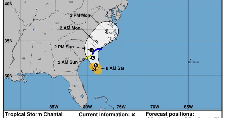
Tropical Storm Chantal formed Saturday morning about 150 miles off the coast of South Carolina, prompting tropical storm warnings for portions of the Carolinas.
The National Weather Service in Miami said the storm was located south-southeast of Charleston, South Carolina and about 240 miles south-southwest of Wilmington, North Carolina. It had maximum sustained winds of 40 mph and was moving at about 2 mph.
Forecasters said the storm is expected to turn to the northeast by Sunday night and the center of Chantal is expected to move across the coast of South Carolina that day.
“Some additional strengthening is expected before Chantal reaches the coast,” the NWS said.
Tropical storm warnings were issued from the South Santee River in South Carolina to Cape Fear, North Carolina, while a tropical storm watch was issued from Edisto Beach to the South Santee River.
Forecasters expect Chantal to produce heavy rainfall across portions of the coastal plain of the Carolinas through Monday with a total rainfall of two to four inches, with local amounts up to six inches. This could result in flash flooding.
The Atlantic hurricane season is from June 1 until Nov. 30, with peak activity typically occurring between mid-August and mid-October.
NOAA officials predicted a 60% chance of an “above-normal” Atlantic hurricane season, with between 13 to 19 named storms. Six to 10 of those are expected to strengthen into hurricanes, and three to five could become major hurricanes, forecasters said.
Source link


